 Valmeyer lies on the eastern edge of a broad floodplain known as the American Bottoms. Beginning in Madison County across from St, Louis, the American Bottom stretches approximately 75 miles south to the mouth of the Kaskaskia River. Along its length, the American Bottoms is bounded by a line of limestone bluffs on the east and by the Mississippi River to the west. While being naturally rich in terms of fertile soil and agricultural yields, this area has been historically prone to flooding. People have always been attracted to the natural beauty and the rich resources of the American Bottoms.
The Village of Valmeyer is the youngest organized community in the County of Monroe, even though there has been abundant activity in this area for many centuries. Evidence has been unearthed to show that marine life existed here during the time when much of the area was under vast ocean areas, and habitation continued into more modern times – at least 5000 years ago when Native Americans populated the areas because of plentiful food sources in the river bottom and on the wooded bluffs nearby.
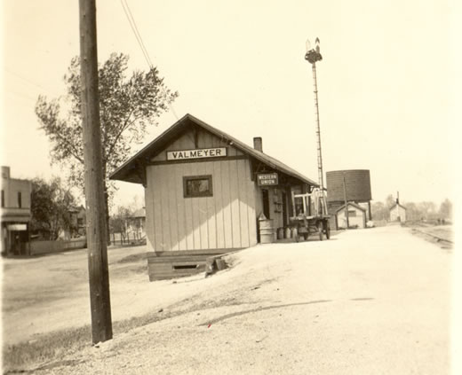
Valmeyer was a bustling community from its beginnings in the early 1900’s, with homes and businesses springing up in support of the local farming community. Development of the railroad line during that same time period brought businesses to the area providing services and jobs for many residents of the community. By 1909 there was a sufficient population to consider organizing the town, and Valmeyer became a Village governed by the laws of the State of Illinois.
Churches and civic organizations have always been busy with their regular activities, and have returned countless benefits to the community. The one-room schoolhouse provided the education foundation for many, and its consolidated descendant continues that tradition, providing a well-rounded education to local youth, in a setting that helped to shape future generations of young adults.
Even though the town center of Valmeyer’s original location was located about four miles from the main channel of the Mississippi River, flooding of that major waterway shaped the future of the Village and its residents. Mississippi River floods reached Valmeyer in 1943, 1944 and 1947, causing substantial damage to homes and businesses, as well as major damage to the crops of area farmers. Following the 1947 Flood, local property owners rallied with legislators to provide some type of flood protection for the area. Support was approved, and between 1947 and 1950, the U. S. Army Corps of Engineers completed a protective levee along the east bank of the Mississippi River that would protect the community for years to come.
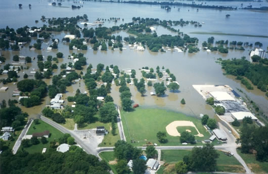 Through the years development continued in Valmeyer with more homes and businesses being constructed. That was all brought to a screeching halt in 1993, when Mississippi River waters overtopped the protective levee system and inundated the Village. When the floodwater receded a majority of the properties were found to be substantially damaged, so the future of the community was in question. Village officials gathered with residents to discuss the options, and it was decided to attempt a relocation of Valmeyer to higher ground. Ground was broken on a new uphill site in December, 1993, and work continued through 1996 to establish relocated Valmeyer more than 400 feet higher in elevation than the original Village site.
Valmeyer has continued to grow in population since that time, and the future of the community is more secure than ever.